Destination briefing
Why travelers stop here
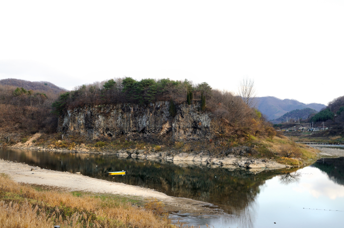
In the Yeoncheon area, sedimentary layers that have not yet been lithified are distributed below the 20–30 m basalt columnar joint cliffs. These sedimentary layers are called the Baeuiryi Formation. First discovered along the Hantangang River in Baeuiryi, Cheongsan-myeon, Yeoncheon-gun, it is named the Baeuiryi Formation. The Baeuiryi Formation mainly consists of conglomerate layers rich in gravel, but some sand layers and mud layers are also found beneath the basalt. This Baeuiryi Formation is a very unique phenomenon observed only in the Hantangang River area in inland Korea, making it a geological site of high educational value. The fact that the Baeuiryi Formation was covered by Cenozoic Quaternary basalt indicates that the current course of the Hantangang River and the old course of the Hantangang River were different. At that time, sediments forming the present Baeuiryi Formation were being deposited in the old Hantangang River, and lava flowed into this old river, forming a thick basalt layer. Over a long period, the basalt was eroded and removed, forming the riverbed of the Hantangang River, which developed into the present Hantangang River. Careful observation of the gravels included in the Baeuiryi Formation reveals that the gravels are arranged in a certain direction, which indicates the direction of the water flow of the old Hantangang River. This is because the gravels are preferentially oriented to minimize resistance to water flow. Above the Baeuiryi Formation, Cenozoic Quaternary basalt lies unconformably, and between them, as hot lava flowed and met the Baeuiryi Formation (the ground surface) in the air, the surface rocks broke and twisted, forming clinkers of various sizes of rock fragments.
(Source: Hantangang River Geopark)
OTA-ready stop
Built into inbound routes and day-tour planning.
Local context
경기도 연천군 연천읍 고문리 212
Travel fit
Attraction · Gyeonggi-do
![[Early bird] Elysian Gangchon Ski Tour from Seoul (5 pick-up points)](/_next/image?url=https%3A%2F%2Fadmin.holidaykr.com%2Fapi%2Fadmin%2Fsystem%2Fbasic-settings%2Ffavicon%3Fpath%3D%252Fuploads%252Fproducts%252Fthumbs%252F750_1785201339504_file1.jpg&w=3840&q=75)